Tsunami Monitor: Live DART Buoy Data
Live from NOAA, NDBC and JMA: DART deep-ocean buoys, official tsunami bulletins as published, and Honolulu sea level.
Alerts shown here are issued by NOAA and the Japan Meteorological Agency and are reproduced as published. Nikola Tesla Web issues no warnings of its own, computes no correlation, and predicts nothing.
WHICH CENTERS ISSUE TSUNAMI ALERTS?
Official bulletins — reported, never inferredUS Active Tsunami Alerts
NWSPacific & National Centers
PTWC / NTWCJapan — JMA
JMA ENWHAT ARE THE DEEP-OCEAN DART BUOYS READING?
Bottom-pressure recorders · sea-surface heightDART 46403 — Alaska
NDBCDART 51407 — Hawaii
NDBCDART 32413 — South Pacific
NDBCDART 21418 — Japan
NDBCDART 41421 — Caribbean
NDBCDART 23401 — Indian Ocean
NDBCWHAT IS THE SEA STATE? — WAVE MODELS
NOAA Ocean Prediction CenterPacific Sea State — Analysis
OPC
Pacific Sea State — 24 hr Forecast
OPC
Pacific Sea State — 48 hr Forecast
OPC
Atlantic Sea State — Analysis
OPC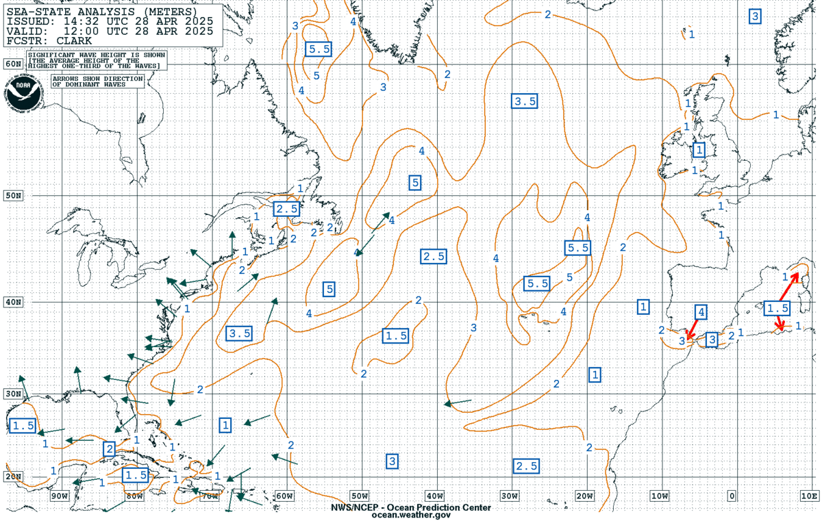
Atlantic Sea State — 24 hr Forecast
OPC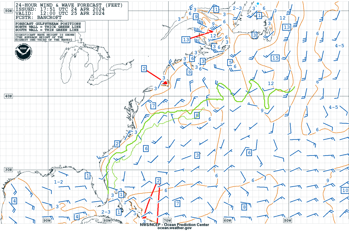
Atlantic Sea State — 48 hr Forecast
OPC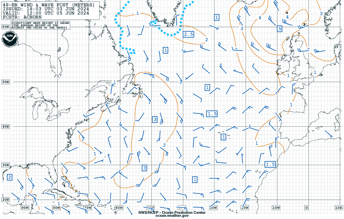
OCEAN CONDITIONS
Basin-scale imageryGlobal Sea Surface Temperature
CORAL REEF WATCH
Where does this page's data come from?
- tsunami.gov (NOAA) — official U.S. tsunami bulletins
- NOAA NDBC — DART deep-ocean buoys
- Japan Meteorological Agency — tsunami bulletins
- NOAA Tides & Currents — Honolulu sea level
- NOAA OPC — sea-state and wave model charts
- USGS — M6.0+ earthquakes
Every live panel on this page is observed measurement or published model output from these sources, reproduced as published.
The Whole Planet. $3.69 a Month.
One price. Every monitor, every feed, every tool. Founding member pricing — locked in for as long as you stay.
Get Full Access — $3.69/mo$3.69/mo locked for life — normal price $9.63/mo · Less than a cup of coffee · Cancel anytime
What do people ask about the Tsunami Monitor?
Where do the tsunami alerts come from?
Alerts shown here are issued by NOAA, through tsunami.gov and its two U.S. tsunami centers, and by the Japan Meteorological Agency. They are reproduced as published — official bulletins, reported, never inferred. Nikola Tesla Web issues no alerts of its own and computes no correlation.
What are DART buoys?
DART stations are NOAA deep-ocean bottom-pressure recorders. A sensor on the seafloor reads the weight of the water column above it, which gives sea-surface height, and a surface buoy relays each reading by satellite. A passing tsunami shows up as a change in that height.
What else does the Tsunami Monitor show?
Recent M6.0+ earthquakes worldwide from the USGS, the largest event of the past 24 hours, Honolulu sea level in metres above mean lower low water, and basin-scale sea state and wave models from NOAA. Every panel is an official measurement or bulletin, shown as the agency published it.
Latest readings
Snapshot taken . The live panels on this page refresh in the browser.
- NWS tsunami alerts
- None active
- M4.5+ earthquakes, past week
- 181 events · largest M7.0 — 191 km ENE of Nagqu, China